
Knowing the specifics of an itinerary
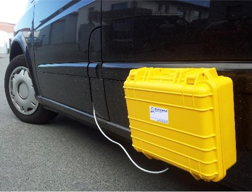
METEO OMNIUM has developed since 2017, thermal cartography to facilitate implanting meteorological stations on a road network. As well, we propose weather forecasting projections on that itinerary with the help of our road forecasting module.
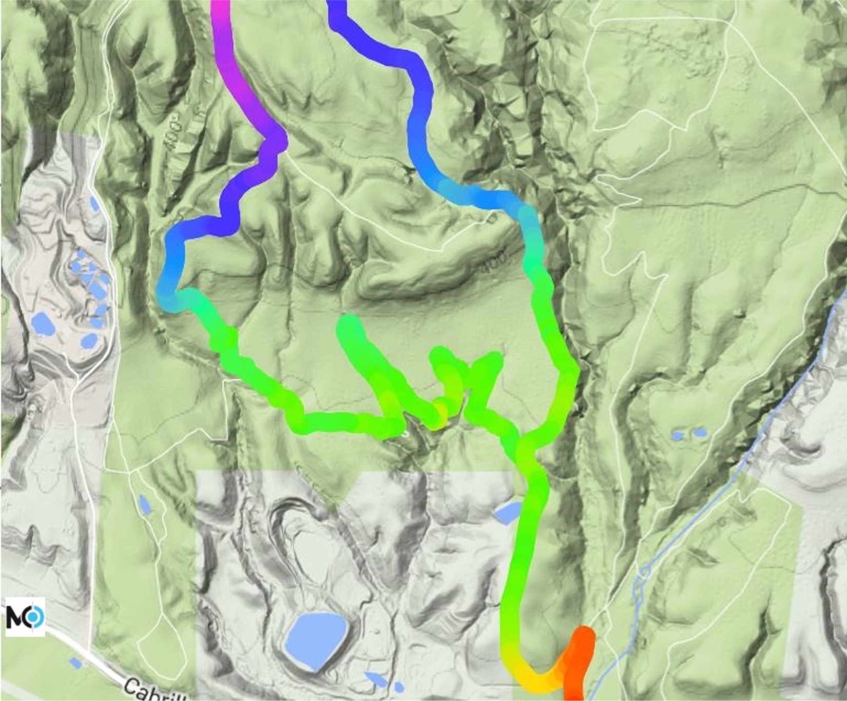
Thermal cartography of the road (or thermal mapping) consists in collecting road surface temperatures on a defined itinerary, in winter, during a period of strong sunlight (clear windless nights). It's in these conditions that we measure the greatest temperatures differences, on the various road segments.
The objective of this mapping is to possess precise information about temperature differences that can exist on an itinerary and identify the coldest points. This cartography is a crucial tool in selecting where to install future road weather stations.
Thermal mapping is also used in our road forecasting model by itinerary.
Measurement results are submitted to our client in a KMZ file format he can use freely.